

Maptech
Maptech Folding Waterproof Chart - Santa Catalina and LA to Dana Point - WPC130
Item: #874127 | Part Number: WPC130
19% off
MSRP: $40.06
$32.17
Description
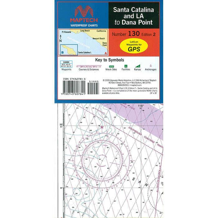
The Maptech Folding Waterproof Chart WPC130 delivers detailed, durable navigation for Santa Catalina and the coastal run from LA to Dana Point. Its unique flip-fold design lets you quickly access key areas without unfolding a full chart, while waterproof, tear-resistant construction ensures reliable use in tough marine conditions. GPS-ready waypoints, pre-plotted courses, and rich local info make it a smart cruising companion.
Maptech Folding Waterproof Chart - Santa Catalina and LA to Dana Point - WPC130 Item # 874127
Description
Maptech's unique flip-fold Waterproof Chart displays extensive and highly detailed coverage of Santa Catalina and LA to Dana Point, including mainland and inland harbors.
Features:
- Unique "Flip-fold" design is like an accordion
- A big improvement over large, cumbersome paper charts
- Spread a chart out to its full width, or keep it folded and flip to your favorite area
- It folds down to a small size that is easy to store and carry, and it opens up to show popular cruising areas
- GPS Ready
- GPS Waypoints for major buoys
- Easy to use with your GPS
- Most charts include one-minute lat./long. grids to make vessel positioning a breeze, and major navigation aids are identified with named GPS waypoints
- Waterproof and Tear-Resistant
- Printed on high-quality, waterproof, tear-resistant paper
- Chart images are crisp and easy-to-read
- They can handle just about any conditions you'll find on the water
- Pre-plotted Courses and Distances
- Maptech's navigation editors add magnetic courses between major navigation aids with distances in nautical miles
- Waterproof Charts are also designed to help you do the calculations yourself
- Each page includes a Compass Rose with annual increase in variation and complete scale information
- The following appears on most Maptech Waterproof Charts
- Wreck Sites
- Artificial Reefs
- Anchorages
- Marinas
- Public Boat Launch Locations
- Pump-Out Information
- Historic Sites
- Fish / Dive Sites and Tables
- Key to Fish Species
- Local Gamefish Illustrations
- State Parks
Note: Some information may not be available on all Maptech Waterproof Charts