C-Map
C-Map MAX 4D Lake Insight HD Electronic Navigation Charts
Item: #864135 | Part Number: Not Selected22% off
$264.27
$204.33 - $264.27

Description
C-MAP MAX 4D Lake Insight HD Electronic Navigation Charts present detailed inland lake maps for fishing and cruising and the high-definition shaded relief provides enhanced views of underwater structure. Features: Custom color palette for user-defined depth ranges Aerial imagery included on chip Sub-1 meter aerial imagery available for download via...

C-Map MAX 4D Lake Insight HD Electronic Navigation Charts Item # 864135

Description
C-MAP MAX 4D Lake Insight HD Electronic Navigation Charts present detailed inland lake maps for fishing and cruising and the high-definition shaded relief provides enhanced views of underwater structure.
Features:
- Custom color palette for user-defined depth ranges
- Aerial imagery included on chip
- Sub-1 meter aerial imagery available for download via free 1-year premium subscription to Insight Genesis
- More than 100,000 total named bodies of water with shoreline detail
- 4,800 Lakes in standard definition with 3' to 10' contours
- 2,400 Lakes in high definition with 1' to 3' contours
- Bird's-eye 3D perspective view
- Easy Routing to create the shortest, safest route based on selected start and end points
- Fishing Hot Spots® POI (points of interest), lake-specific fishing tips and techniques
- High-resolution bathymetric data at higher zoom levels
- State-specific fish and wildlife ID photos, regulations and records
- ActiveCaptain crowd-sourced POI
Specifications:
- Media: Micro SD card with SD card adapter
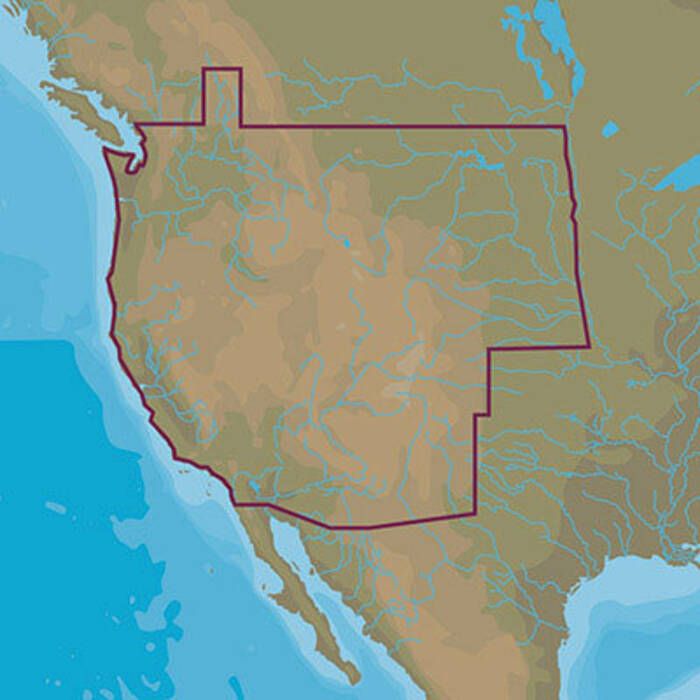
- Coverage Area: West US (WA, OR, ID, MT, WY, ND, SD, NE, CA, NV, UT, AZ, CO, NM)
- Coverage Area: North Central US (MN, WI, MI, IA, IL, IN)
- Coverage Area: North East US (NY, VT, NH, ME, MA, CT, RI, OH, PA, NJ, MD, DE, KY, WV, VA)
- Coverage Area: South East US (TN, NC, SC, AL, GA, FL)
- Coverage Area: South Central US (KS, MO, OK, AR, TX, LA, MS)
Chartplotter Compatibility:
- FURUNO
- GP1670
- GP1670F
- GP1870
- GP1870F
- HUMMINBIRD
- ION
- ONIX
- ONIX SI
- RAYMARINE
- a, c, e, eS, g, gS Series (Lighthouse II v13 or above)
- Dragonfy Series
- Axiom
- Axiom Pro

